Feature reference (not a verified entrance)
Hierve el Agua
Last reviewed: not yet Next review
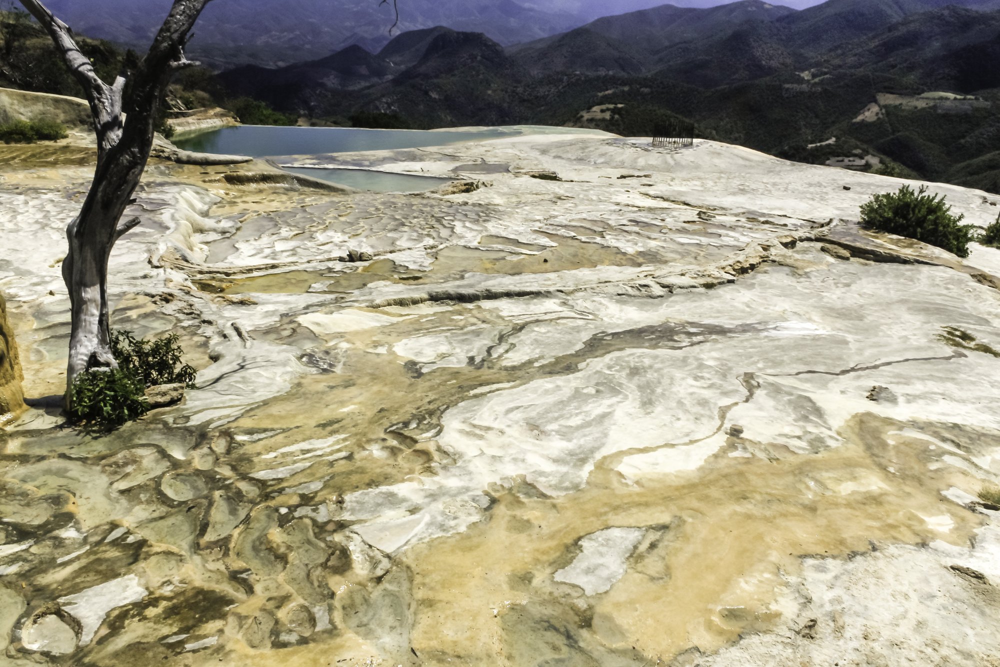
Mineral springs in the mountains of Oaxaca that have built white travertine petrified waterfalls down two cliffs.
Access
We haven't checked access for this place. Check the land manager's or local tourism site for hours, fees and closures, and stay off private or closed land.
Safety & respect
Stay on marked paths and behind barriers. Ground near caves, sinkholes, geysers and cliffs can be unstable or hot. The cliff edges beside the pools are high and unguarded.
Lore note
About 70 km east of Oaxaca City, two rock shelves rise 50 to 90 m above a narrow valley, and pale travertine hangs from them like frozen waterfalls, one about 12 m long and the other about 30 m. Springs at the top carry water oversaturated with calcium carbonate, and as it trickles over the edge it leaves the minerals behind, much as stalactites grow in caves. The Zapotecs cut terraces and irrigation canals here as long as 2,500 years ago, a system thought unique in Mesoamerica, and the place was probably sacred to the early peoples of the Oaxaca valley. The name is Spanish for the water boils.
Map links
Official / public map link · Approx. 16.8655, -96.2760: feature coordinate, not a checked entrance · Pin source: Wikidata Q155246 P625, cross-checked against OpenStreetMap (Hierve el Agua viewpoint, within 0.01 km) · Marks the springs and cliff tops, not a particular formation.
Sources
- Wikipedia, Hierve el Agua (CC BY-SA 4.0; read 12 Nov 2026): https://en.wikipedia.org/wiki/Hierve_el_Agua
- Wikidata, Q155246 (coordinate location P625, country P17; read 12 Nov 2026): https://www.wikidata.org/wiki/Q155246
About 70 km east of Oaxaca City, two rock shelves rise 50 to 90 m above a narrow valley, and pale travertine hangs from them like frozen waterfalls, one about 12 m long and the other about 30 m. Springs at the top carry water oversaturated with calcium carbonate, and as it trickles over the edge it leaves the minerals behind, much as stalactites grow in caves. The Zapotecs cut terraces and irrigation canals here as long as 2,500 years ago, a system thought unique in Mesoamerica, and the place was probably sacred to the early peoples of the Oaxaca valley. The name is Spanish for the water boils.
This entry is part of our world atlas. The summary above is written in our own words from the Wikipedia article, and the map pin uses published coordinates cross-checked against Wikidata. We haven’t visited this place or checked current access.