Feature reference (not a verified entrance)
Waw an Namus
Last reviewed: not yet Next review
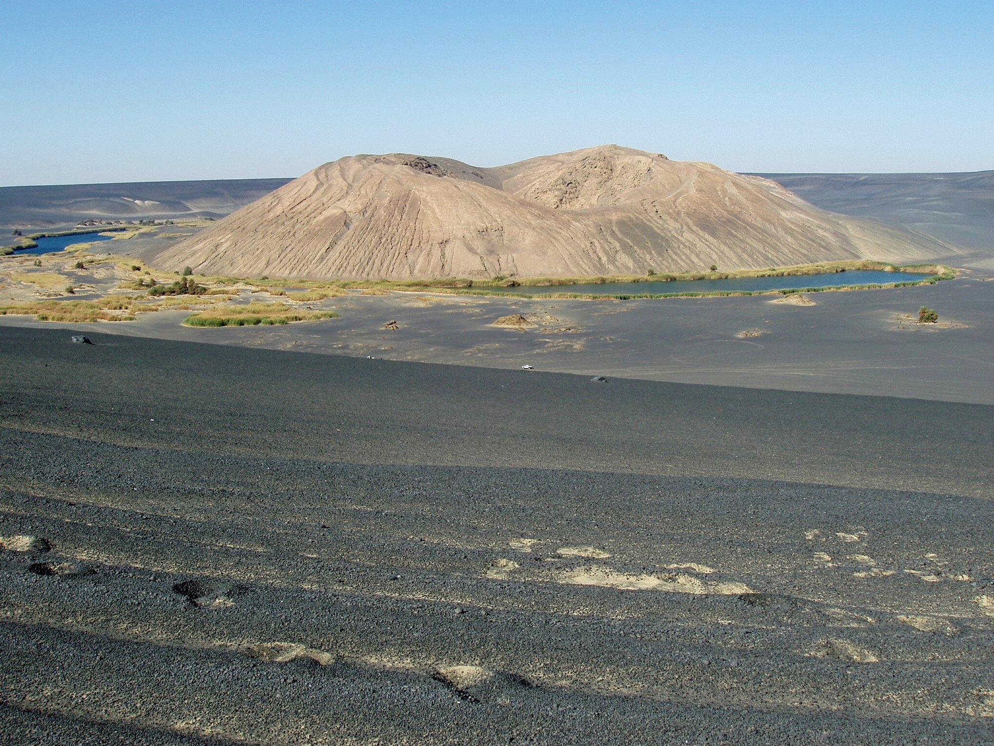
A black volcanic caldera in the middle of the Sahara with small coloured lakes and reeds, its name meaning oasis of mosquitoes.
Access
We haven't checked access for this place. Check the land manager's or local tourism site for hours, fees and closures, and stay off private or closed land.
Safety & respect
Stay on marked paths and behind barriers. Ground near caves, sinkholes, geysers and cliffs can be unstable or hot.
Lore note
Waw an Namus is a caldera wrapped in an apron of dark ash that stands out sharply against the pale desert of southern Libya. Inside are a scoria cone and several small lakes fringed with plants, the only water for a very long way. The name means oasis of mosquitoes. Its age is unclear: dating gives about 200,000 years, but other evidence hints at much more recent activity. Ancient graves have been found nearby.
Map links
Official / public map link · Approx. 24.9175, 17.7628: feature coordinate, not a checked entrance · Pin source: Wikipedia article coordinates, cross-checked against the OpenStreetMap peak for Waw an Namus (within 0.5 km). Wikidata stores a rounded point about 2.3 km away, which we did not use
Sources
- Wikipedia, Waw an Namus (CC BY-SA 4.0; read 12 Nov 2026): https://en.wikipedia.org/wiki/Waw_an_Namus
- Wikidata, Q171653 (coordinate location P625, country P17; read 12 Nov 2026): https://www.wikidata.org/wiki/Q171653
Waw an Namus is a caldera wrapped in an apron of dark ash that stands out sharply against the pale desert of southern Libya. Inside are a scoria cone and several small lakes fringed with plants, the only water for a very long way. The name means oasis of mosquitoes. Its age is unclear: dating gives about 200,000 years, but other evidence hints at much more recent activity. Ancient graves have been found nearby.
This entry is part of our world atlas. The summary above is written in our own words from the Wikipedia article, and the map pin uses published coordinates cross-checked against Wikidata. We haven’t visited this place or checked current access.