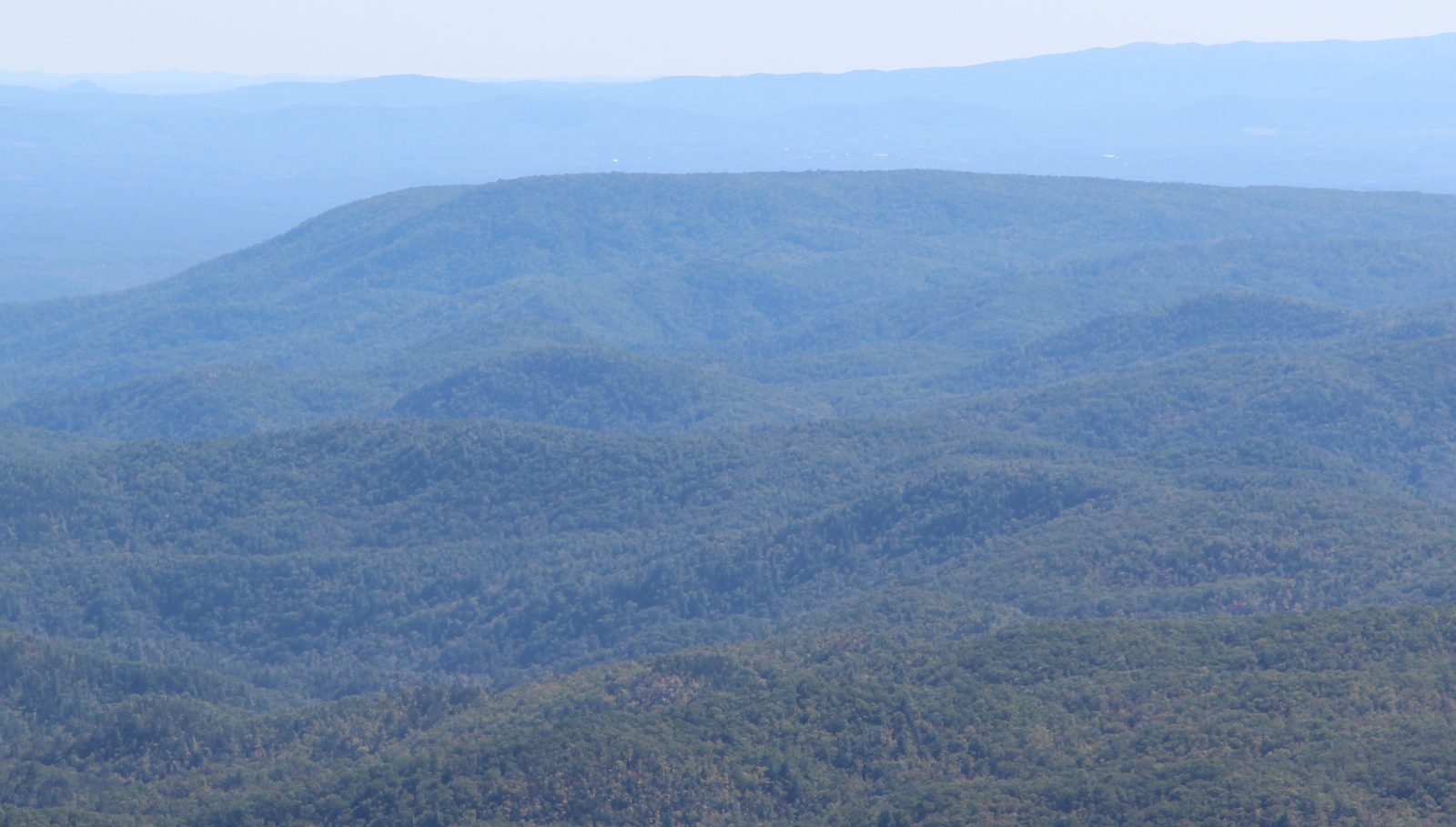
Brown Mountain Overlook (NC 181)
A free roadside overlook in Pisgah National Forest facing Brown Mountain, the classic place to watch for the Brown Mountain Lights. In 1922 a USGS geologist set up survey instruments in this country and traced most of the lights he saw to car and train headlights.
Access
Roadside parking overlook on the east side of NC 181 in Pisgah National Forest (Grandfather Ranger District). No fee. Burke County Tourism gives directions: from Morganton, 14 miles north on NC 181, overlook on the right. Post-Helene status (checked Oct 2026): the Forest Service's 22 May 2025 Helene update for the Grandfather Ranger District did not list the overlook among closed Burke County sites, but we found no more recent agency notice that names it either way. The ledger is holding the map pin until access after Helene is confirmed. Before you go, check NC 181 conditions on DriveNC.gov and current closures on the National Forests in North Carolina site. No decimal pin is given because no agency publishes one; the map uses a place search.
Safety & respect
NC 181 is a fast, curving mountain highway. Park fully inside the overlook, never on the shoulder, and use hazard awareness getting in and out at night. Don't walk the road. The National Forest Foundation advises against driving the rugged dirt sections of the Pisgah Loop at night; if you come for the lights, make it an out-and-back on pavement. Helene left new hazards across this district: downed trees, washouts and unstable slopes. Stay at the overlook; don't go down slope or into the gorge in the dark. Pack out trash.
Lore note
Reports of lights over Brown Mountain became well known in the early 1900s. Burke County Tourism describes them as a glowing ball of fire, a bursting skyrocket or a pale, almost white light that drifts, fades and brightens, or whirls like a pinwheel and darts away, and says they continue to confound scientific explanation. Two federal looks at the lights exist: a 1913 USGS visit that blamed locomotive headlights, and George R. Mansfield's 1922 instrument survey (reprinted as USGS Circular 646), which traced about 47 percent of the lights he recorded to automobile headlights, 33 percent to locomotive headlights, 10 percent to stationary lights and 10 percent to brush fires.
Sources
- Burke County Tourism Development Authority — Brown Mountain Lights (directions, viewing notes): https://www.discoverburkecounty.com/all-attractions/brown-mountain-lights/
- George R. Mansfield, Brown Mountain Lights, North Carolina (1922 press notice), republished as U.S. Geological Survey Circular 646 (1971): https://pubs.usgs.gov/publication/cir646 · PDF: https://pubs.usgs.gov/circ/1971/0646/report.pdf
- The Monroe Journal (Monroe, NC), 26 May 1922, p.2, “Brown Mountain's Light Has Been Solved at Last” (Library of Congress, Chronicling America; checked on the page image by the research desk): https://www.loc.gov/resource/sn91068476/1922-05-26/ed-1/?sp=2
- USDA Forest Service, National Forests in North Carolina — More Helene-Impacted Trails and Recreation Sites Reopen on Grandfather Ranger District (22 May 2025): https://www.fs.usda.gov/r08/northcarolina/newsroom/releases/more-helene-impacted-trails-and-recreation-sites-reopen
- National Forests in North Carolina — current alerts and closures: https://www.fs.usda.gov/r08/northcarolina
- NCDOT DriveNC traveler information (road conditions): https://drivenc.gov/
The Brown Mountain Lights are one of the oldest ghost-light stories in the country, and one of the few that a federal agency went out and measured. Watching from this overlook, on a clear night after rain, you’re standing in roughly the same kind of spot the surveyors used.
Two federal visits: 1913 and 1922
According to the USGS report, the first published description of the lights was a dispatch from Morganton to the Charlotte Daily Observer, dated 23 September 1913. Within weeks the Survey sent geologist D. B. Sterrett, who watched for a light on 11 October 1913 and declared the lights were locomotive headlights. Then the great flood of 1916 washed out the valley railroads. People kept seeing lights while no trains were running, and Sterrett’s answer fell out of favor. That is why the Survey went back in 1922. Its findings went out that year as Press Notice 14328 and were reprinted as Circular 646 in 1971.
The press notice traveled. That spring, North Carolina papers ran it under headlines like the Monroe Journal’s “Brown Mountain’s Light Has Been Solved at Last” (26 May 1922). The research desk checked that page against the image. The paper relayed the Survey’s main point flatly: “The lights do not originate on or near Brown mountain.” It said the lights come from the lower country miles beyond and have nothing to do with St. Elmo’s fire. A headline announcing a solved mystery hasn’t stopped people from watching for a century since.
What the USGS found in 1922
In March and April 1922, USGS geologist George R. Mansfield spent several evenings at viewing points around Brown Mountain with a planetable, a telescopic alidade and local guides who knew the lights well. Every time a light appeared, he took a bearing on it. Later he plotted the lines on a map, drew terrain profiles and checked them against railroad schedules.
His figure, reproduced below from the USGS reprint, shows the result: lines of sight running from the viewing stations across Brown Mountain and out into the Catawba Valley, toward roads, rail lines and towns.
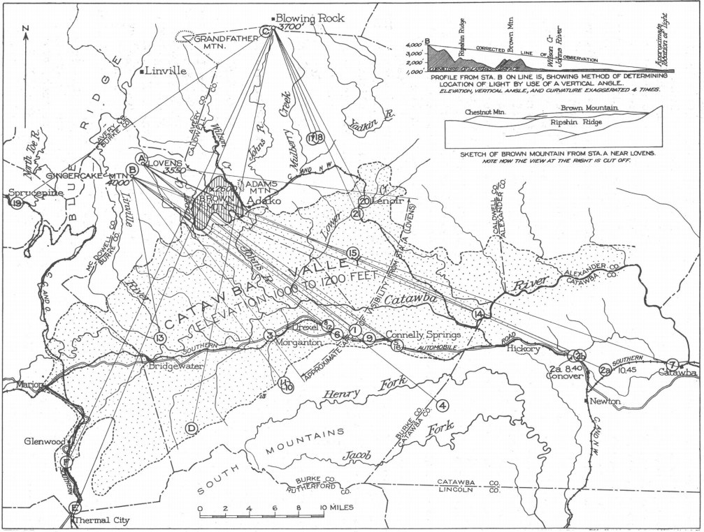
Figure 1 from G. R. Mansfield, Brown Mountain Lights (1922), U.S. Geological Survey Circular 646 (1971). Public domain (U.S. government work), via Wikimedia Commons.

His conclusions:
- Of 23 lights recorded with instruments, 11 were probably automobile headlights and 7 were locomotive headlights. An eighth was probably a train too. Most of the rest were stationary lights and brush fires. In his summary: about 47 percent cars, 33 percent trains, 10 percent stationary lights and 10 percent brush fires.
- Train lights were matched by plotting the bearings and checking them against railroad registers and schedules. At least one light that a local guide accepted as a true Brown Mountain light lined up with a train.
- He found “no geologic basis” for the idea that the lights were natural wonders of any kind.
- He pointed to the basin of unstable air below Brown Mountain. After sunset, cool air drains in from different valleys, so the density of the air between the viewer and a distant light keeps changing. That makes far-off lights flare, dim and seem to go out. Because the lights are seen at very shallow angles, the effect is as strong as it gets.
- He addressed the 1916 objection directly. An earlier USGS man, D. B. Sterrett, had blamed locomotive headlights after a 1913 visit, and people dropped that idea when lights were still seen after the great flood of 1916 stopped the trains. Mansfield’s answer was that automobile headlights, increasingly powerful and numerous in the valley, account for many of the lights too.
Motion is a big part of the lore. On one of his survey nights, two observers said they saw a light waver or move. Each time, Mansfield checked it through the telescope and found its position unchanged.
Ledger reading
Cited, for most of the lights. The 1922 survey is still the best-documented study of Brown Mountain, and the valley today has far more headlights than it did then. Some modern observers say they’ve seen lights that don’t behave like headlights. The ledger hasn’t seen instrument data for those, and keeps that part of the question open.
Viewing notes
Burke County Tourism says the lights are seen on clear nights from points along NC 181 and from Wiseman’s View in the Linville Gorge Wilderness, and its visitor center (140 N. Sterling St., Morganton; Mon–Fri 9–5 Eastern, as of Oct 2026) hands out a viewer’s guide. Mansfield’s notes show fog and valley mist spoiling several survey nights. Bring binoculars and a red light. If you see one, note the direction and time. That’s exactly the data Mansfield used.