Trailhead / site map
Tonto Natural Bridge State Park
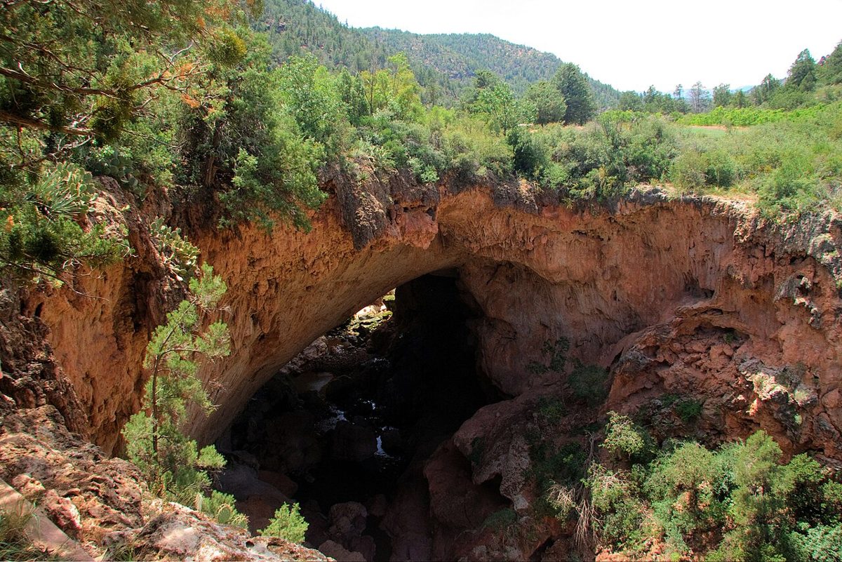
A travertine arch 183 feet high over a 400-foot tunnel on Pine Creek, between Payson and Pine. It may be the largest natural travertine bridge in the world. Its famous 'discovery' story is one the park's own history page treats as legend.
Access
Arizona State Parks, day use, ticketed. Hours (as of Oct 2026, check the park site): 9 a.m.–5 p.m., last entry 4 p.m.; trails close an hour before the park does. Thanksgiving and Christmas Eve 9 a.m.–2 p.m.; closed Christmas. Entrance fees (as of Oct 2026, check the park site): adult (14+) $10, youth (7–13) $5, child (0–6) free. Dogs aren't allowed on the trails.
Safety & respect
The park says every trail is under half a mile long, but they're steep and strenuous. Allow an hour or more and carry water. Wet travertine is slick, so stay on marked trails and obey ranger closures. The canyon floor gets hot in summer, and Pine Creek can flash-flood during the monsoon. Pine Creek valley was a seasonal home of the Tonto Apache people, per the park's history. Treat that as history, not lore.
Lore note
The popular story says prospector David Gowan found the bridge in 1877 while hiding from Apaches for three days. Arizona State Parks' history page calls that a local legend that was never backed up in writing. It also gives a 1921 recollection placing a first visit in 1880, and records Gowan's 1882 homestead. Other published accounts give 1877 or 1878, so there are three dates for one 'discovery.'
Map links
Official / public map link · Approx. 34.3348, -111.4211 (public reference only — verify on official maps before travel)
Sources
- Arizona State Parks — Tonto Natural Bridge State Park (hours, fees; checked 3 Oct 2026): https://azstateparks.com/tonto
- Arizona State Parks — Tonto Natural Bridge park history: https://azstateparks.com/tonto/explore/park-history
- Arizona State Parks — Tonto Natural Bridge maps (GPS coordinates to park entrance, 34.334825, −111.421065 WGS84): https://azstateparks.com/tonto/explore/maps
- Arizona Highways archive (repeats the 1877 date): https://www.arizonahighways.com/archive/issues/chapter/Doc.950.Chapter.5
- Discover Gila County — David Douglas Gowan, Rim Country legend (gives 1878): https://discovergilacounty.com/blog-categories-adventure/david-douglas-gowan-rim-country-legend/
Pine Creek has cut a tunnel about 400 feet long through a mass of travertine. Travertine is a limestone deposited by mineral-rich springs. The arch over the tunnel stands 183 feet high, and the tunnel is 150 feet across at its widest. Arizona State Parks says it may be the largest natural travertine bridge in the world. Short, steep trails drop to the creek and look up into the opening.
Legend vs. record
This park is a neat example of the ledger’s status labels. The story everyone tells is that a prospector, David Gowan, found the bridge in 1877 while hiding from Apaches for three days. The park’s own history page calls that a local legend and says it was never confirmed in writing. It gives a 1921 recollection by prospector I. M. House that puts a first visit in 1880. What is documented is Gowan’s 1882 homestead on the land.
The record also goes back further than the legend. The park notes that an 1866 Army volunteer company out of Fort Lincoln (later Fort Verde) saw the bridge and forcibly removed a Tonto Apache camp from the valley. Pine Creek was a seasonal home of the Tonto Apache long before any “discovery.”
Other published accounts disagree on the date. An Arizona Highways archive piece gives 1877 as fact, and Gila County’s tourism blog gives 1878. That’s three dates (1877, 1878 and 1880) for one discovery that the official history treats as legend.
On the Rim
Tonto Natural Bridge is the nearest public, officially mapped place to the Rim country of Mogollon Monster storytelling. See the Mogollon Monster in print. The ledger doesn’t pin sightings, camps or reservation land. For more Rim country, see Woods Canyon Lake.
Make it a day
The bridge is the first stop on the ledger’s Rim country day trip, which goes on to Pine and Strawberry. That page carries a dated notice about the under-bridge trail closures after rain.
Safety callouts
Steep, slick trails. Every trail is under half a mile, but they’re steep, and wet travertine is slippery. Stay on marked trails and follow ranger closures. After rain the park closes the trails under the bridge.
Heat and flash floods. The canyon floor heats up in summer. Pine Creek can flood fast during the July–September monsoon. Don’t go down if storms are building upstream.
Archivist’s margin
Go for the arch. Come away with a lesson in how “discovery” stories get written over older history.