Shoofly Village (Tonto National Forest)
A free day-use Forest Service interpretive site north of Payson, where a short trail passes the stone wall footings of a village people lived in from about A.D. 1000 to 1250. It's archaeology and public history, and a fragile site.
Access
USDA Forest Service, Tonto National Forest; public day-use site. Hours (as of Oct 2026, check the Forest Service site): day use only, 6 a.m.–10 p.m. No fees (as of Oct 2026, check the Forest Service site). No overnight camping and no trailers. Directions per the Forest Service: take AZ 87 north from Payson to Houston Mesa Road and turn east; the parking lot is a short way past the Mesa del Caballo subdivision. Picnic tables, ramadas and toilets are on site. Contact: Payson Ranger Station, 1009 E. Highway 260, (928) 474-7900 (weekdays).
Safety & respect
Stay on the interpretive trail. Don't climb on walls, move rocks, or pick up or pocket pottery sherds; disturbing an archaeological site on federal land is illegal under the Archaeological Resources Protection Act (ARPA). Report looting or vandalism to the Forest Service at 1-800-VANDALS. Summer brings monsoon lightning and heat: carry water, and leave if a storm builds. Expect seasonal fire restrictions. Pets on leash only. Pack out your trash.
Lore note
The Forest Service describes Shoofly as a village occupied from about A.D. 1000 to 1250 that once had 79 structures. The outlines of its rock walls are still visible, and a low rock wall encloses about 3.75 acres. The agency calls the site very fragile. The people who built Shoofly are ancestors of living communities. This page treats the site as archaeology and public history only.
Map links
Sources
- USDA Forest Service, Tonto National Forest — Shoofly Village (hours, fees, directions, site description; read 4 Oct 2026): https://www.fs.usda.gov/r03/tonto/recreation/shoofly-village
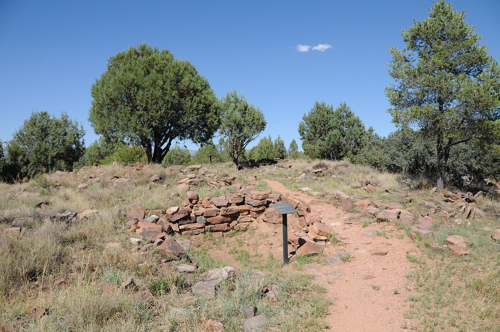
Shoofly Village is a short, easy stop off Houston Mesa Road north of Payson. A trail loops past low stone footings and interpretive signs on a juniper-dotted rise. There’s nothing mysterious here. It’s a good place to see how archaeologists read a village from what’s left on the ground.
What the Forest Service says is here
- When: the village was lived in from about A.D. 1000 to 1250.
- How big: it once had 79 structures. A low rock wall encloses about 3.75 acres.
- What you can see: the outlines of the rock walls are still visible.
- Condition: the agency calls the site very fragile.
The people who built and lived in Shoofly are ancestors of living communities. This page doesn’t attach any legend, mystery or spiritual claim to the site. Wall footings and room counts are the story.
Callouts
Stay on the trail and don’t touch. Don’t climb on or lean against the walls, move rocks, or pick up pottery sherds. Disturbing an archaeological site on federal land is illegal under the Archaeological Resources Protection Act. If you see looting or vandalism, report it to the Forest Service at 1-800-VANDALS.
Heat and lightning. The rise is open to the sun. Carry water, and in monsoon season (summer) leave when storms build. Lightning is a real risk on open ground. Expect seasonal fire restrictions.
No map pin
The ledger doesn’t pin ancestral sites on its map. Use the Forest Service page for directions. For other public Rim-country stops nearby, see Tonto Natural Bridge State Park.
This page is for curiosity and trip planning. It isn’t safety or navigation advice, and Anomaly Ledger accepts no liability for your visit. Check the Forest Service site for current hours and conditions before you go.
Make it a day
Shoofly is the first stop on the ledger’s Payson and Mogollon Rim day trip.
Image credit
Photo: “Shoofly Village Ruin, Village Architects Site” (2019) by Richard N Horne, via Wikimedia Commons, licensed under CC BY-SA 4.0. Resized for the web; no other changes.

Archivist’s margin
The best artifact at Shoofly is the one you leave where it is.