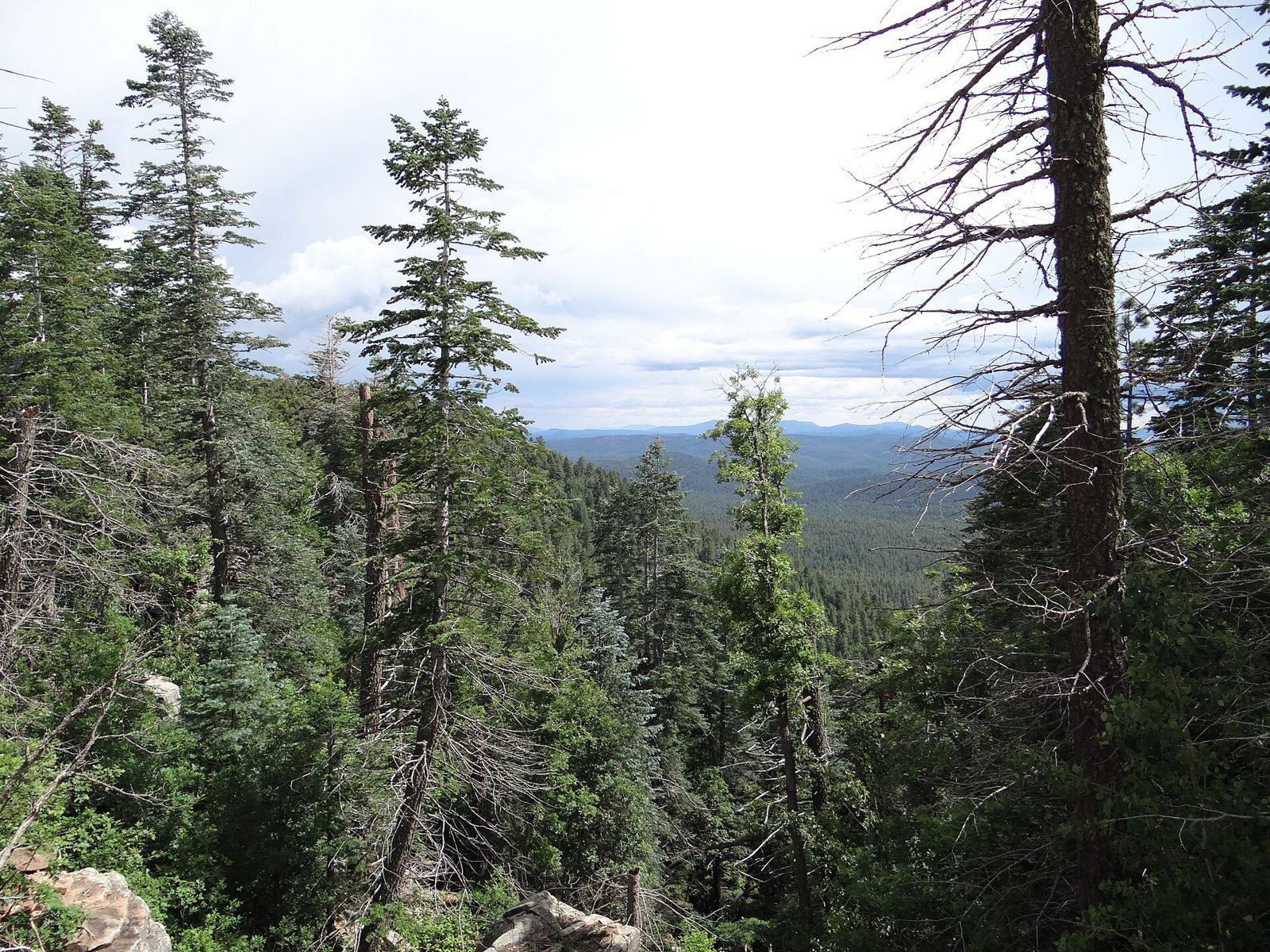
Payson and the Mogollon Rim: Shoofly Village, the Rim Lake Vista Trail & Green Valley Park
A Rim country day out of Payson: the stone footings of Shoofly Village, a walk along the edge of the Mogollon Rim on the paved Rim Lake Vista Trail (the visitor center is closed for the season), then Green Valley Park and the Rim Country Museum back in town. Archaeology, a campfire legend’s thin paper trail, and real Rim hazards.
The day in one paragraph
Start north of Payson at Shoofly Village, where a short walk circles the stone outlines of a village lived in from about A.D. 1000 to 1250. Then take SR 260 east up onto the Rim to the Mogollon Rim Visitor Center, closed for the season in October but still the trailhead for a paved walk along the Rim Lake Vista Trail. Come back down to Payson for Green Valley Park and, Thursday to Saturday, the Rim Country Museum. We don't publish drive times or stop-to-stop mileage, because they depend on the day. Use a current map and AZ511.
-
Shoofly Village (Tonto National Forest)
A free day-use Forest Service interpretive site north of Payson, where a short trail passes the stone wall footings of a village people lived in from about A.D. 1000 to 1250. It's archaeology and public history, and a fragile site.
Getting there
- From Payson, take Highway 87 north to Houston Mesa Road and turn east. The parking lot is a short way past the Mesa del Caballo subdivision, just off the paved road. No trailers. (USFS: Shoofly Village)
- A separate Forest Service clean-up and restoration order (1 Sep 2026 – 30 Apr 2027) closes forest land on the west side of Houston Mesa Road, between the road, SR 87 and the Houston Mesa Campground boundary. Don’t stop or park on that side; check the order’s map. (USFS: Houston Mesa area closure order)
On site
- Day use only, 6 a.m.–10 p.m., with no overnight camping. No fees (as of Oct 2026, check the Forest Service site). There’s no potable water. (USFS: Shoofly Village)
- The Forest Service page contradicts itself on toilets: its directions mention picnic tables, ramadas and toilets, but its restroom listing says no toilet is available. Plan as if there isn’t one. (USFS: Shoofly Village)
- The village was occupied from about A.D. 1000 to 1250 and once had 79 structures, whose rock outlines are still visible. At its center was a building of about 26 rooms, part of it perhaps two stories high. The compound of about 3.75 acres is enclosed by a small rock fence. (USFS: Shoofly Village)
An ancestral site, so no map pin from us: use the Forest Service directions. The Forest Service doesn’t name descendant communities, and neither do we. Read it as archaeology: how a village is reconstructed from knee-high wall outlines.
-
Mogollon Rim Visitor Center & Rim Lake Vista Trail
A Forest Service log-cabin visitor center on AZ 260 and a 4.3-mile trail along the edge of the Mogollon Rim, about 2.5 miles of it paved. The visitor center is seasonal and is likely closed now; the trail runs beside drops of 150 feet or more.
Approx. 34.3023, -110.8955 (public reference — verify on official maps before travel) Getting there
- Take SR 260 east from Payson. The visitor center is a log cabin on the south side of the highway, about 32 miles east of Payson, with paved parking just past milepost 282. (USFS: Mogollon Rim Visitor Center)
- SR 260 passes through ADOT’s Lion Springs work zone east of Payson; see the dated road callout at the top of this page. (ADOT: SR 260 Lion Springs Improvement Project)
On site
- The visitor center is seasonal: open Memorial Day through Labor Day, Thursday–Sunday, 9 a.m.–3:30 p.m. It’s closed for the season in October, so treat this as a viewpoint and trailhead stop. The page lists vault toilets and two picnic tables, with more tables and grills at Fulton Point Picnic Area on FR 171, directly south. No potable water. We couldn’t confirm whether the toilets stay open off-season. (USFS: Mogollon Rim Visitor Center)
- Rim Lake Vista Trail #622 runs 4.3 miles along the Rim from the Rim Top Trailhead to Mogollon Campground and Trailhead. About 2.5 miles are paved, from just west of Military Sinkhole to Mogollon Campground. The main trailhead is just off FR 300, across from the visitor center. Walk an out-and-back on the paved section and turn around when you like. (USFS: Rim Lake Vista Trail #622)
- The trail “closely follows the edge of the Mogollon Rim, which is a vertical drop of 150 feet or more in many areas.” And the Forest Service warns: “The Mogollon Rim is the second most lightning struck area in the world.” (USFS: Rim Lake Vista Trail #622)
Bring water, layers and lunch. There’s no food at the visitor center, and the top of the Rim is a lot cooler than Payson.
-
Green Valley Park, Payson
The Town of Payson's lakeside park: three small lakes, walking paths, a playground and fishing docks, with the Rim Country Museum and Zane Grey Cabin on the same parkway. No legend attached. It's the ledger's town stop for Rim country days.
Approx. 34.2315, -111.3439 (public reference — verify on official maps before travel) Getting there
- Green Valley Park is at 1000 W. Country Club Drive, Payson. Park hours are 6 a.m.–10:30 p.m. (as of Oct 2026, check the town or AZGFD site). (Arizona Game & Fish: Payson community fishing waters)
- The Rim Country Museum and Zane Grey Cabin are at 700 S. Green Valley Parkway, north of Main Street. Phone 928-474-3483. (Rim Country Museum (official site))
On site
- Green Valley Park has three lakes totaling 12 acres, with walking trails, a playground and accessible fishing docks. Swimming and wading are prohibited, and so is full-body contact, because the lake receives treated effluent. No gas motors; boating only between sunrise and sunset. Animals must be leashed. (Arizona Game & Fish: Payson community fishing waters)
- Museum hours (as of Oct 2026, check the museum site): Thursday 1–4 p.m., Friday and Saturday 10 a.m.–4 p.m. Admission is $5 for adults per attraction (museum or cabin), $4 for seniors over 55 and veterans, $3 for juniors 12–17, and free for children under 12. The museum is self-guided, the cabin tour is docent-led, and the outdoor exhibits are free. (Rim Country Museum (official site))
The museum’s own pages don’t agree on Thursday hours, so call before a Thursday visit. It’s closed Sunday to Wednesday.
Make it longer: Pine and Strawberry
For a second Rim country day, or to swap out the Payson afternoon, the ledger's Rim country day trip goes up SR 87 to Tonto Natural Bridge, lunch in Pine and Strawberry. The bridge's last entry is 4 p.m., so do it early.
Legend vs. record
Shoofly is the record. What's there is physical evidence: wall outlines that archaeologists read as 79 structures, a multi-room core building, and an enclosing rock fence. The interesting question isn't what lurked here. It's how you get from knee-high stone outlines to a building that was perhaps two stories high. The people who lived here are ancestors of living communities, not a vanished people.
The Mogollon Monster is the legend. Rim country's campfire creature has a thin, late paper trail. The earliest known use of the name in print is a 1967 newspaper article about a Boy Scout trip, known only through a magazine's report; the paper itself hasn't been identified. The often-cited 1903 "wild man" story isn't a Rim story at all: it's set in the lower Grand Canyon. The ledger tracks both in the Mogollon Monster in print and the Grand Canyon wild man of 1903. We pin no sightings, camps or tribal land, and we don't treat the monster as anyone's sacred being. Please don't go "monster hunting" off trail or onto private land, Scout camps included.
Camping on the Rim (as of Oct 2026, check USFS)
- Closing after Columbus Day weekend (Mon 12 Oct 2026): Rim Campground, about a mile up FR 300, and Mogollon Campground, at the west end of Trail #622, are both listed as generally open May 1 through Columbus Day weekend. Single sites are $18 a night. (USFS: Rim; USFS: Mogollon) The Rim Campground page contradicts itself on drinking water, so bring your own.
- Open through 31 Oct 2026: Canyon Point (on SR 260 east of the visitor center; single site $38, electric $50), Aspen and Spillway (both at Woods Canyon Lake; $35 and $36), and Sinkhole (at Willow Springs Lake; $25) are listed as generally open May 1 through October 31. (USFS: Canyon Point; Aspen; Spillway; Sinkhole)
- Wildlife: the Aspen Campground page says deer, skunks and bears are common campground visitors. Store food properly. (USFS)
- No roadside guessing. Don't camp along SR 260 or near the Lion Springs work zone. Check the closure orders and alerts for both forests before you plan anything outside a developed campground. (Tonto NF alerts; Apache-Sitgreaves alerts)
Sources
- USFS Tonto NF: Shoofly Village
- USFS Tonto NF: Houston Mesa Area clean-up & restoration closure (order 03-12-04-26-23)
- USFS Tonto NF: all alerts
- USFS Apache-Sitgreaves NFs: Mogollon Rim Visitor Center
- USFS Apache-Sitgreaves NFs: Rim Lake Vista Trail #622
- USFS Apache-Sitgreaves NFs: all alerts
- USFS Apache-Sitgreaves NFs: Rim Campground
- USFS Apache-Sitgreaves NFs: Mogollon Campground
- USFS Apache-Sitgreaves NFs: Canyon Point Campground
- USFS Apache-Sitgreaves NFs: Aspen Campground
- USFS Apache-Sitgreaves NFs: Spillway Campground
- USFS Apache-Sitgreaves NFs: Sinkhole Campground
- ADOT: SR 260 Lion Springs Improvement Project (lane restrictions, blasting notice)
- AZ511: ADOT traveler information
- Arizona Game & Fish: Payson community fishing waters (Green Valley Park)
- Rim Country Museum and Zane Grey Cabin (official site)