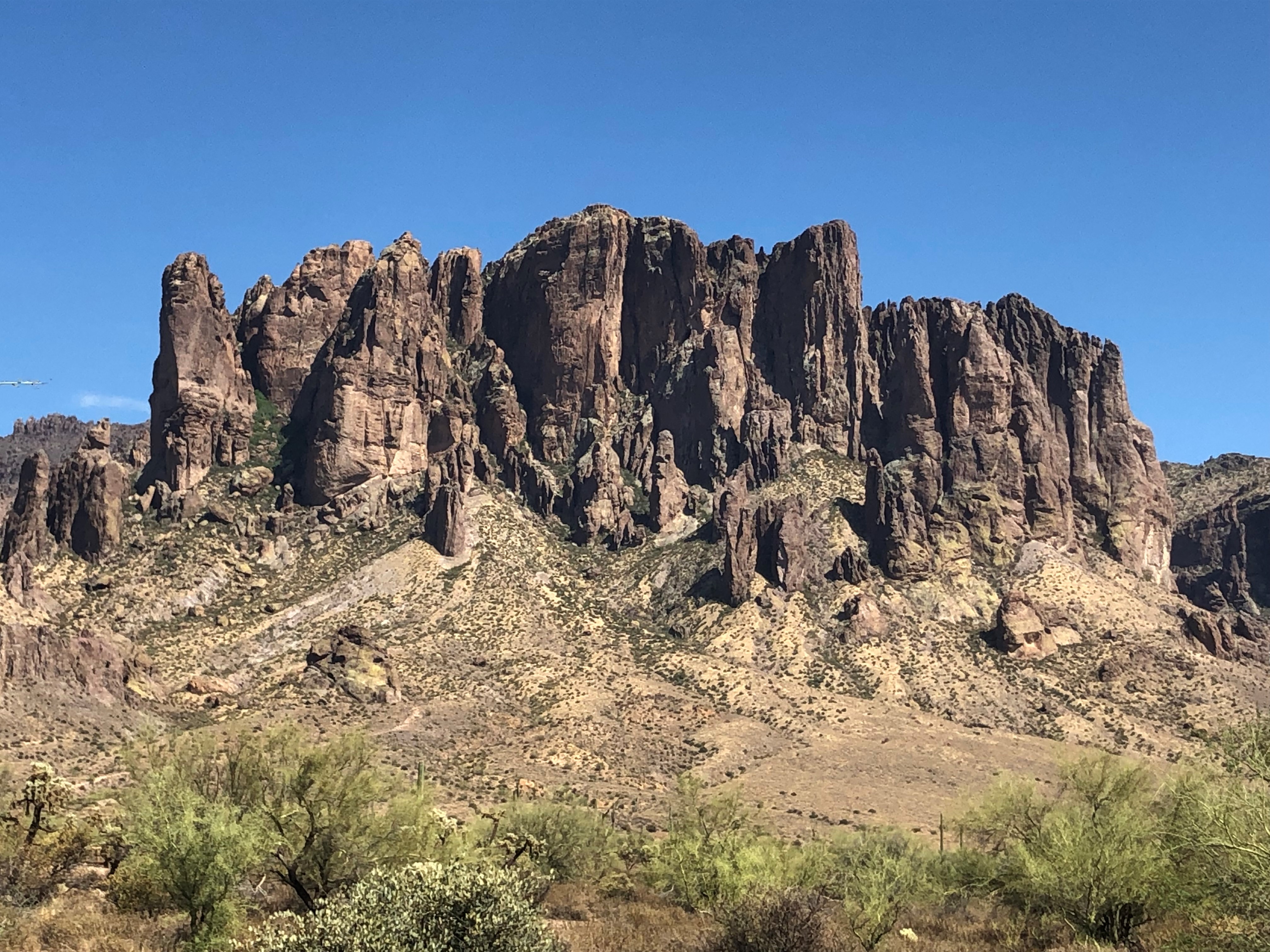
Superstition Mountains day loop
Peralta, Lost Dutchman State Park, and First Water in one East Valley day — three public trailheads under the Dutchman legend, with agency-sourced access notes and no treasure maps.
The loop in one paragraph
From Phoenix or the East Valley, the three public front doors to the Superstition Wilderness split around Apache Junction: Peralta to the south off US 60, Lost Dutchman State Park and First Water to the north on SR 88 (the Apache Trail). A sensible order is Peralta first while it’s coolest, Lost Dutchman State Park at midday for restrooms and short trails, and First Water last only if your vehicle can handle an unmaintained dirt road. You can also run it in reverse. We don’t publish drive times or stop-to-stop mileage — the agency pages don’t, and we won’t guess.
-
Peralta Trail to Weaver’s Needle View
Tonto National Forest day hike to Fremont Saddle — Dutchman folklore under a public Wilderness skyline, not a treasure map.
Approx. 33.3976, -111.3479 (public reference — verify on official maps before travel) Getting there
- Drive east on US 60 about 8.5 miles past Apache Junction to Peralta Road / Forest Road 77, then north about 8 miles to the trailhead. (USFS — Peralta Trailhead)
On site
- No fees listed. (USFS — Peralta Trailhead)
- Potable water is not available at this site. (USFS — Peralta Trailhead)
- Peralta Trail #102 runs 6.2 miles from the trailhead to Dutchman’s Trail #104; most use is concentrated between the trailhead and Fremont Saddle. The trail is often down to bedrock with difficult footing. (USFS — Tonto NF trails list)
Fremont Saddle and the Weaver’s Needle view are the turnaround for most day hikers. Turn around there; the legend does not need you to go farther.
-
Lost Dutchman State Park
Arizona State Parks camp-and-hike basecamp under the Superstition front — named for the legend, run for fees, hours, and marked trails.
Approx. 33.4642, -111.4820 (public reference — verify on official maps before travel) Getting there
- Back toward Apache Junction, then State Route 88 north approximately seven miles from US 60; the park entrance is on the right. (Arizona State Parks — Lost Dutchman maps & directions)
On site
- Entrance fee: $10 per vehicle (1 person), $20 per vehicle (2–4 people), $5 individual/bicycle. Only cash, or Visa/MasterCard with a readable stripe, accepted. (Arizona State Parks — Lost Dutchman)
- Trails 6 a.m.–8 p.m.; day-use gates are closed and locked 8 p.m.–6 a.m. Visitor center/park store 6 a.m.–3:30 p.m. (hours may vary). (Arizona State Parks — Lost Dutchman)
- Walk-in entry and hiker drop-off/pick-up are not permitted (posted safety notice). (Arizona State Parks — Lost Dutchman)
The easy legal on-ramp: restrooms, a visitor center, and the Native Plant Trail. Siphon Draw toward the Flatiron is a serious climb — not an add-on for a hot afternoon.
-
First Water Trailhead · Dutchman’s Trail Corridor
USFS day-use gateway into the Superstition Dutchman trail network — high-clearance approach, wilderness rules, no overnight at the lot.
Approx. 33.4794, -111.4426 (public reference — verify on official maps before travel) Getting there
- From SR 88, take the First Water Trailhead road (approach notes on the Place file; the USFS page lists no mileage). The road to the trailhead is not paved; high-clearance and 4WD vehicles are recommended, and it is not maintained for passenger vehicles. (USFS — First Water Trailhead)
On site
- Day use only; no overnight camping allowed. No fees required. (USFS — First Water Trailhead)
- Vault toilets. (USFS — First Water Trailhead)
- Camping is also prohibited along First Water Road (NFSR 78) itself: from SR 88 to the trailhead, within 300 feet of the road, and at any lot or pullout along it. The Forest Service closure order runs 12 Jan 2026 to 11 Jan 2031. (USFS — Bulldog Canyon and SR 88 camping closure)
- Superstition Wilderness rules: no mechanized or motorized travel; groups of no more than 15 people. (USFS — First Water Trailhead)
If your car is not built for an unmaintained dirt road, skip this stop — the Lost Dutchman skyline already did the work.
Up the Apache Trail: SR 88, Canyon Lake and camping
Past Lost Dutchman, SR 88 keeps climbing toward Canyon Lake and Tortilla Flat. ADOT says the road was built in 1904 as construction access for Roosevelt Dam, and that much of it east of Tortilla Flat keeps its original character (ADOT: SR 88). If you add this drive, these are the things that have changed recently:
- Canyon Lake is closed through 28 Feb 2027. A Tonto National Forest order for the lake drawdown closes every recreation site around the lake from 8 Sep 2026 to 28 Feb 2027, including the marina, the lakebed, and Acacia, Palo Verde, Boulder, Laguna and Tortilla Campground. Forest Road 80 is closed too. SR 88 and Boulder Canyon Trail #103 stay open as boundary routes. Entering the closed area is a federal misdemeanor. (USFS: Canyon Lake closure; USFS: Tortilla Campground, which also shows "closed until further notice")
- No camping along the SR 88 corridor sites. A separate order prohibits camping from 12 Jan 2026 to 11 Jan 2031 along First Water Road (NFSR 78), at the horse-trailer lot next to SR 88 near milepost 203, and at the Bulldog Canyon OHV staging areas (with set distances along their roads). The Forest Service cites resource damage, abandoned property, camp trash and wastewater dumping. Use the order's maps, not roadside guesses. (USFS: SR 88 camping closure)
- Beyond Tortilla Flat, the pavement ends. ADOT says SR 88 is unpaved from Fish Creek Vista (milepost 222) to milepost 227, and the 1.5 miles at Fish Creek Vista are steep, winding and narrow. The page's top banner says "4-wheel drive only and no trailer" signs are currently posted there. Older text further down the same page still says there are no vehicle restrictions, so check AZ511 (or call 511, not while driving) for the live status. This page doesn't report road conditions. (ADOT: SR 88)
Our suggestion for a day loop is to turn around at Tortilla Flat and leave Fish Creek Hill for a separate, well-prepared trip.
Food and a legal campsite (as of Oct 2026)
- Tortilla Flat (1 Main Street, Tortilla Flat, on SR 88): open Mon–Fri 10 a.m.–6 p.m. and Sat–Sun 8 a.m.–6 p.m., with weekend breakfast 8–10:30 a.m. Its saloon and restaurant, store and small museum are all on the boardwalk. (Tortilla Flat)
- Mammoth Steakhouse & Saloon, Goldfield Ghost Town (4650 N. Mammoth Mine Rd., off SR 88): the site says it's open daily but that hours vary, so call 480-983-6402. It's closed on Thanksgiving, Christmas, Easter and Orthodox Easter. (Goldfield)
- Lost Dutchman State Park campground: 135 sites and three group areas. 68 sites have electric and water, and every site has a table and a fire pit with a grill. Rates and booking are on Arizona State Parks' reservation system. (Arizona State Parks: Lost Dutchman camping)
About the legend
The Lost Dutchman story is the reason these trailheads share a name, and it is best carried as folklore. This page is not a mine-hunting guide: we don’t publish “secret” coordinates, off-trail routes, or digging advice, and prospecting or cross-country “treasure” scrambles are a fast way into trouble — legal, physical, or both. Enjoy the view of Weaver’s Needle from the trail.
The documented side of the story is the 1931 disappearance of Adolph Ruth, which the ledger files as disputed: Adolph Ruth, Superstitions 1931.
Sources
- USFS — Tonto NF, Peralta Trailhead
- USFS — Tonto NF, Trails (Peralta Trail #102)
- USFS — Tonto NF, First Water Trailhead
- Arizona State Parks — Lost Dutchman State Park
- Arizona State Parks — Lost Dutchman maps & directions
- Arizona State Parks — Lost Dutchman RV & tent camping
- ADOT — State Route 88 (Apache Trail) project page
- AZ511 — ADOT traveler information (live road conditions)
- USFS — Tonto NF, Canyon Lake Drawdown Public Safety Closure (order 03-12-00-26-22)
- USFS — Tonto NF, Bulldog Canyon and SR 88 Recreational Area Camping Closure (order 03-12-03-26-00)
- USFS — Tonto NF, Tortilla Campground
- Tortilla Flat (business site): hours and address
- Goldfield Ghost Town (business site): Mammoth Steakhouse & Saloon